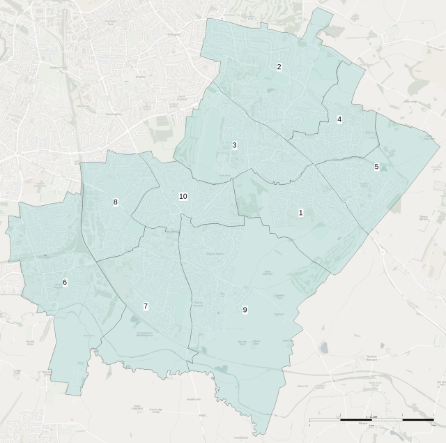
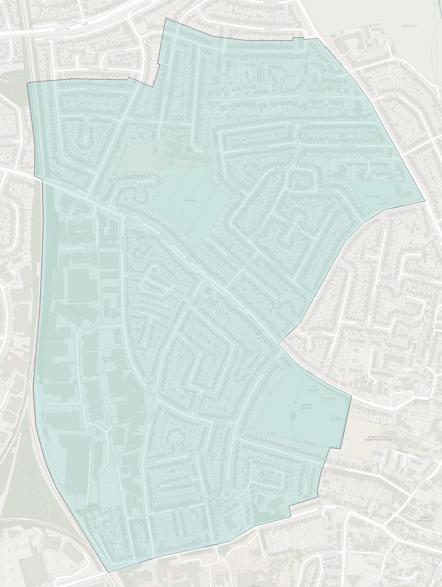
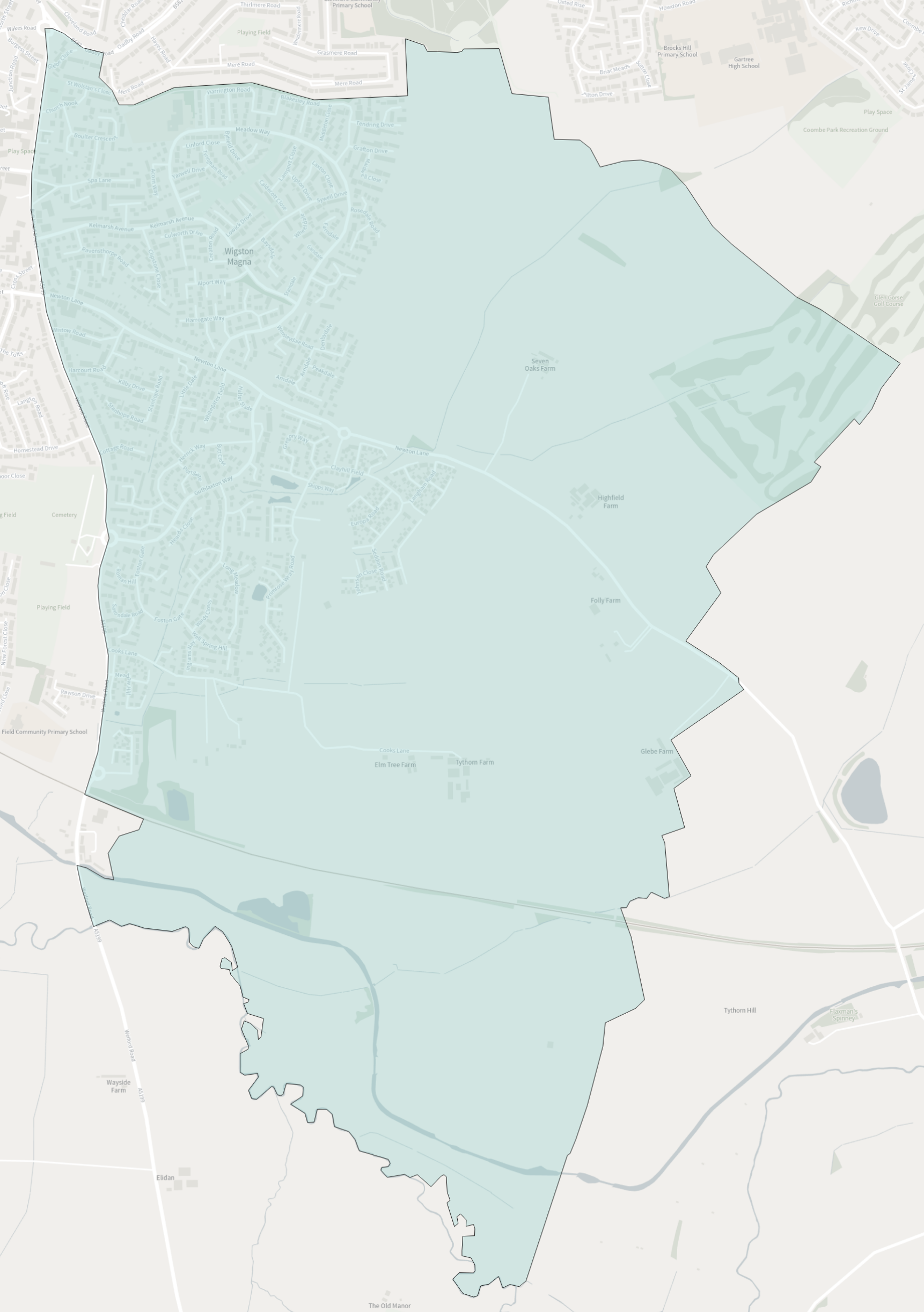
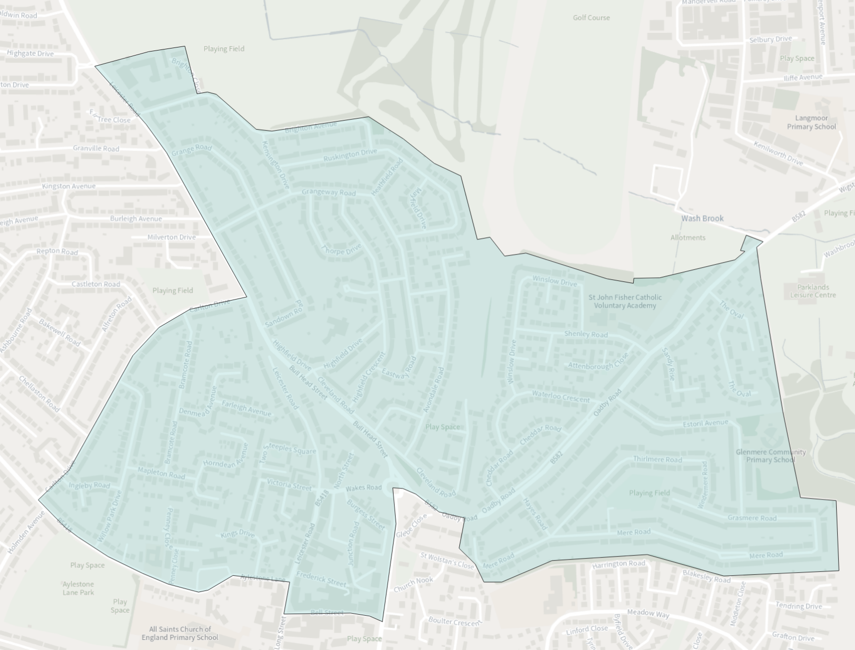
There are 10 electoral wards across Oadby, Wigston and South Wigston as shown on the map below.
Individual ward maps and a breakdown of the number of Councillors representing each ward is as follows.
Ref |
Ward |
No. of Councillors |
|---|---|---|
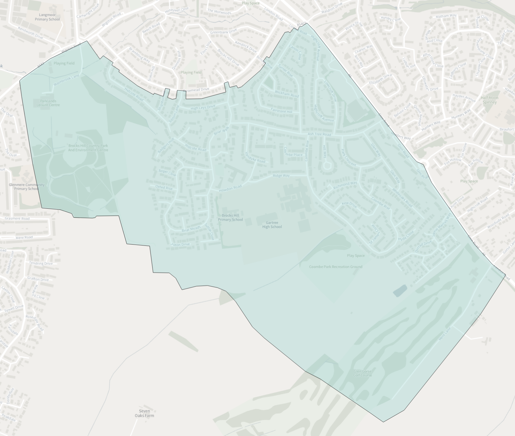
| 1 | Oadby Brocks Hill Ward Map (PNG Image, 1.15 Mb) | 2 |
| 2 | Oadby Grange Ward Map (PNG Image, 1.23 Mb) | 3 |
| 3 | Oadby St. Peter's Ward Map (PNG Image, 1.25 Mb) | 2 |
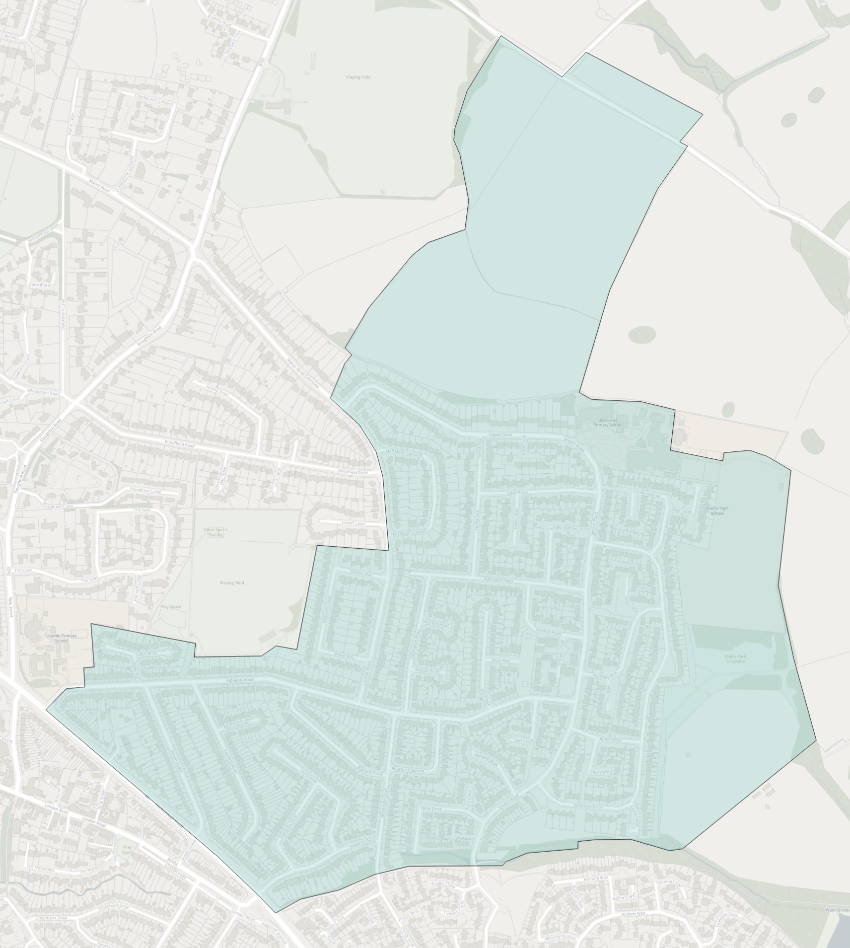
| 4 | Oadby Uplands Ward Map (PNG Image, 2.12 Mb) | 2 |
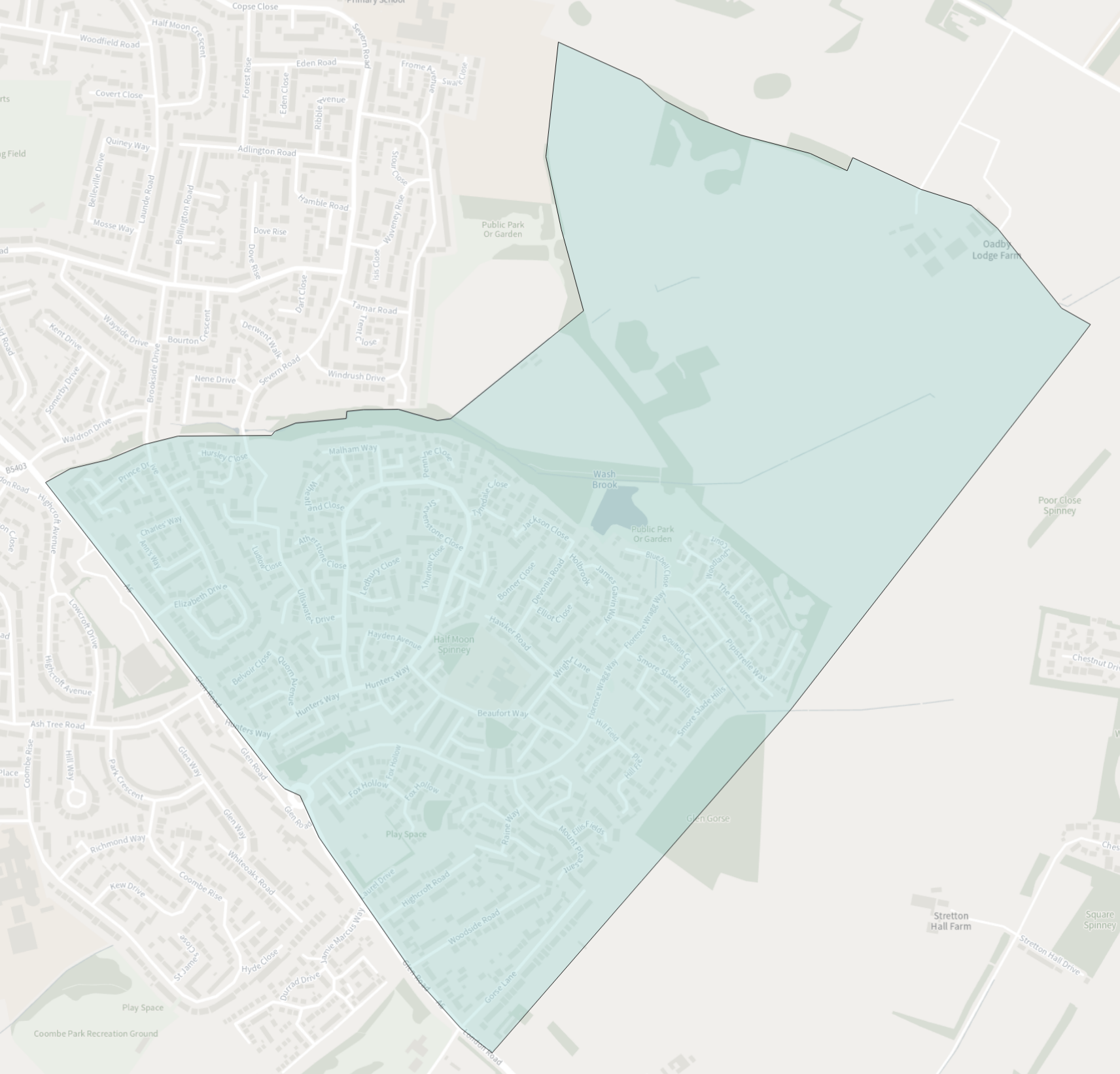
| 5 | Oadby Woodlands Ward Map (PNG Image, 1.23 Mb) | 2 |
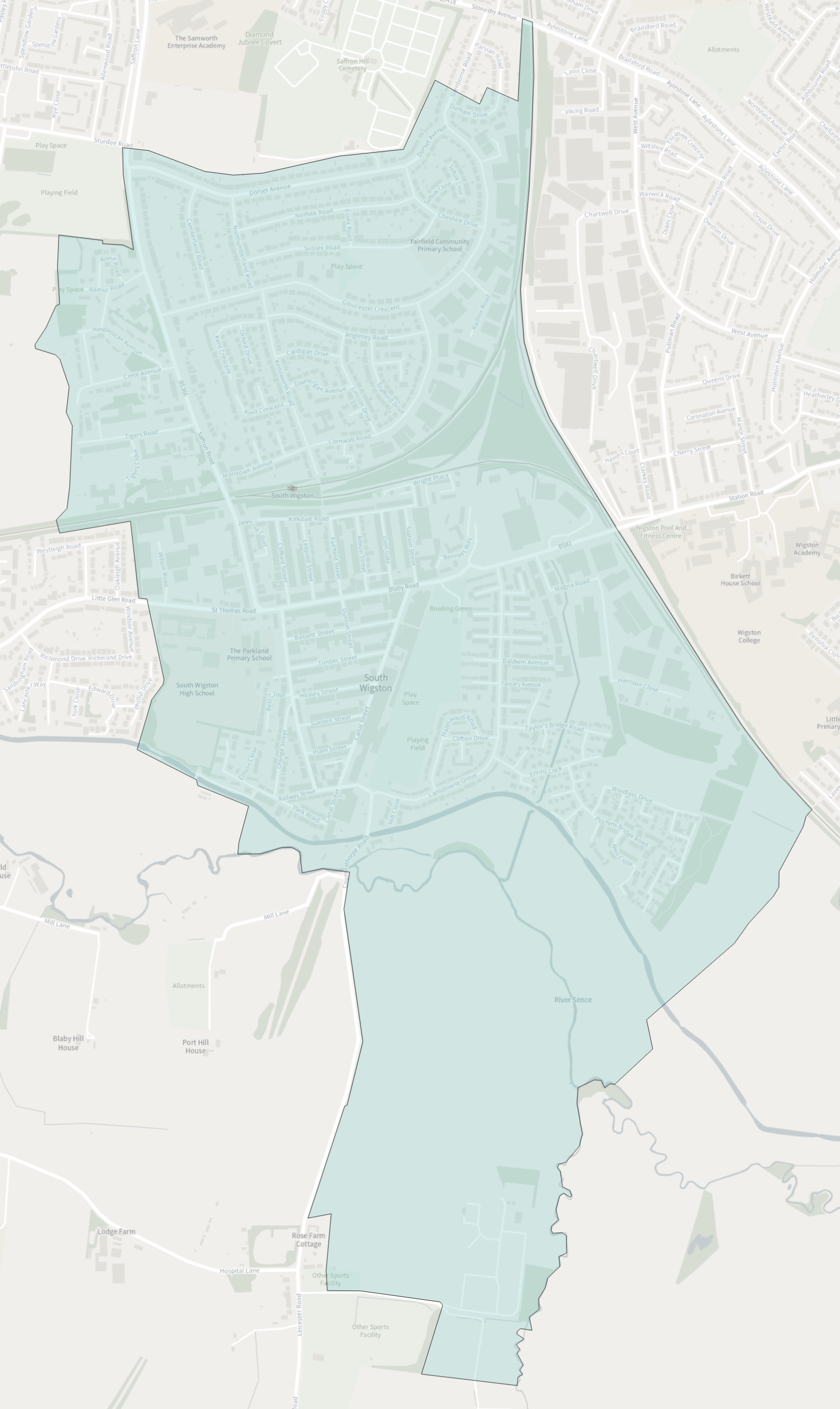
| 6 | South Wigston Ward Map (PNG Image, 1.91 Mb) | 3 |
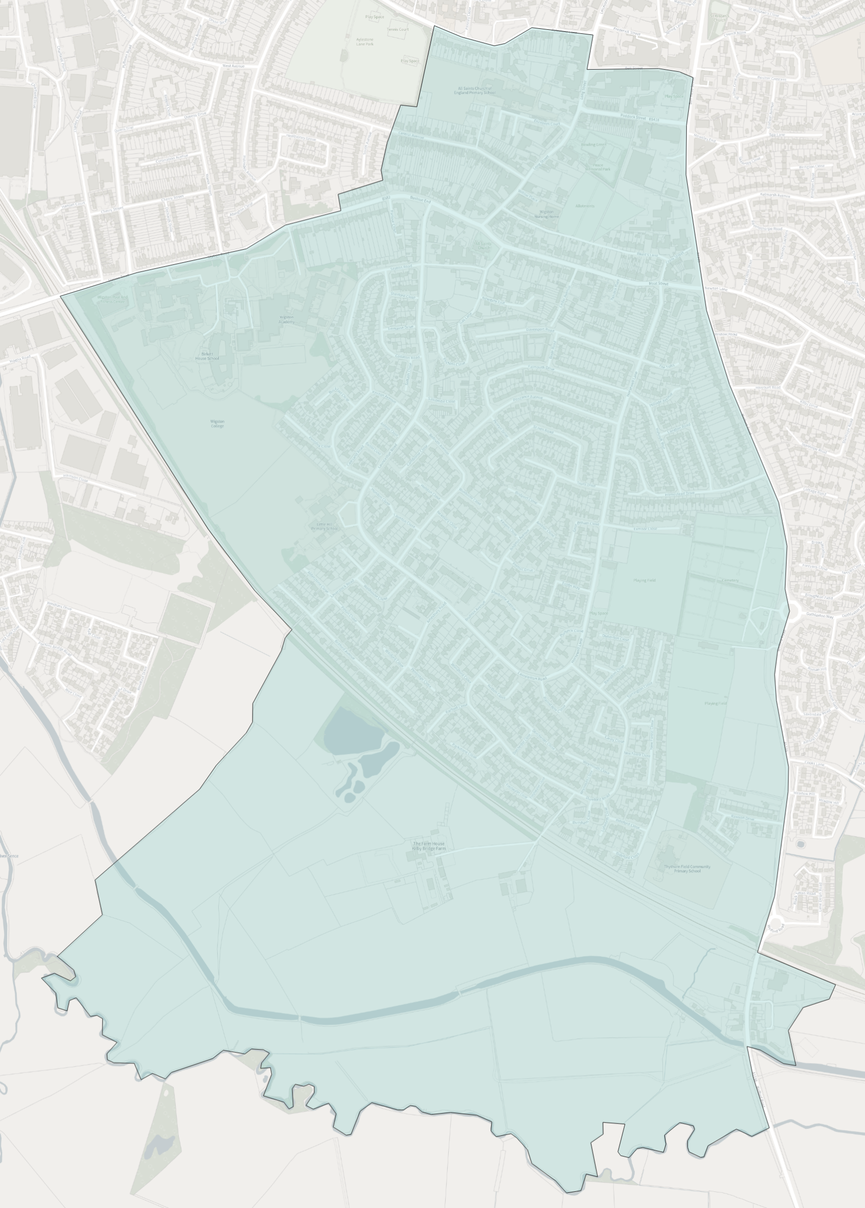
| 7 | Wigston All Saints Ward Map (PNG Image, 2.96 Mb) | 3 |
| 8 | Wigston Fields Ward Map (PNG Image, 3.44 Mb) | 3 |
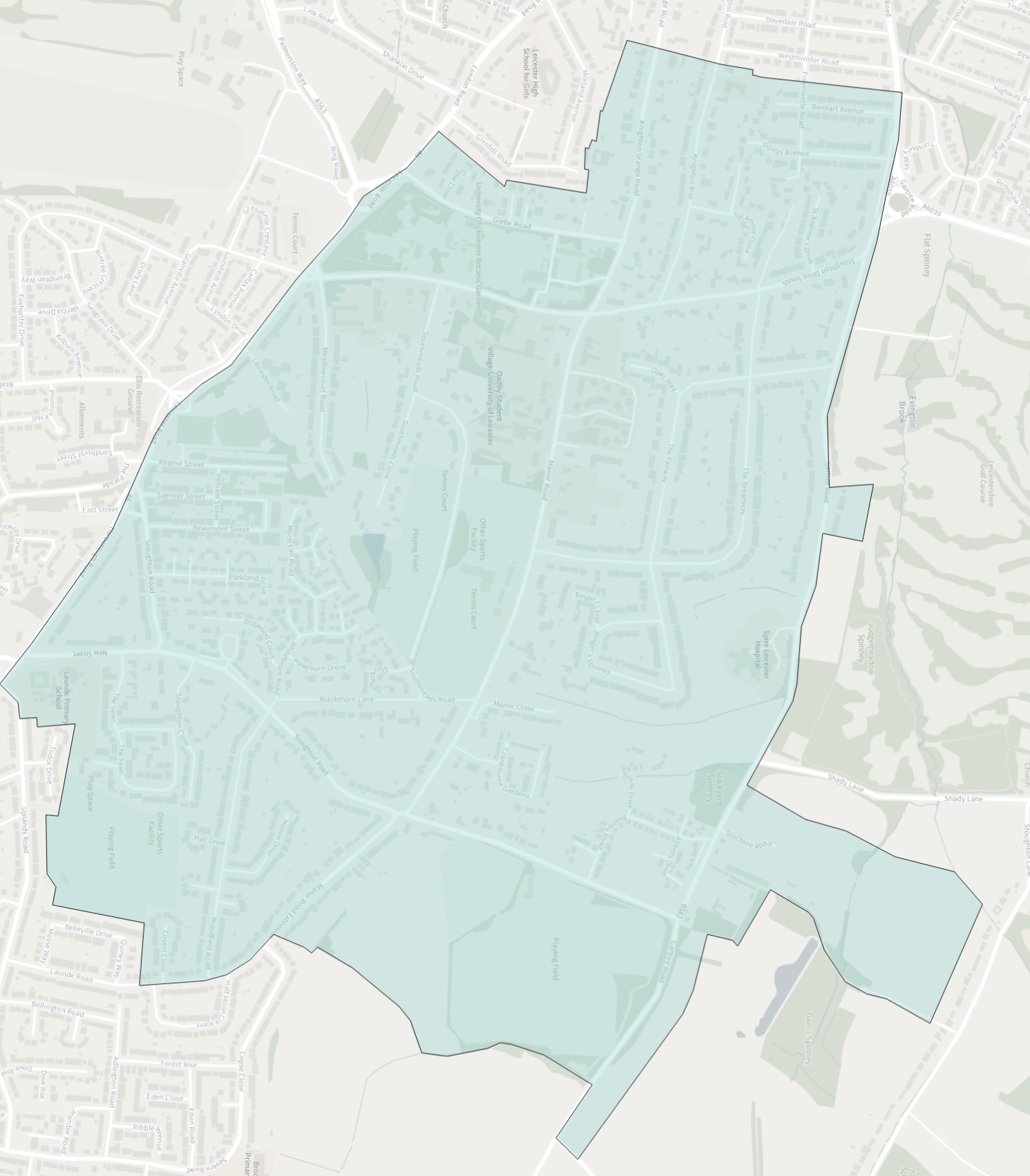
| 9 | Wigston Meadowcourt Ward Map (PNG Image, 1.23 Mb) | 3 |
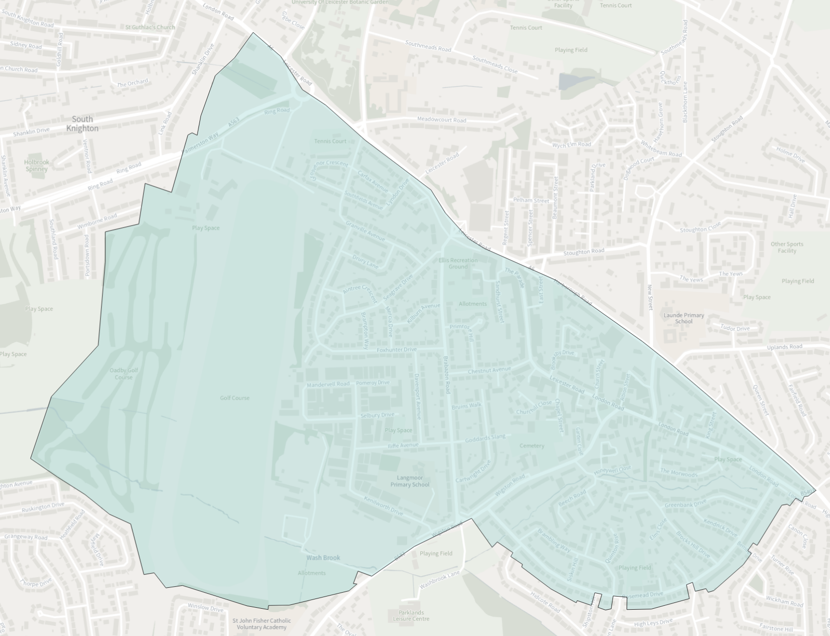
| 10 | Wigston St. Wolstan's Ward Map (PNG Image, 1.19 Mb) | 3 |
Last updated: Monday, 23 October 2023 6:12 pm